Sunday, February 23, 2014

A picture - never seen before and never the same again

A couple of weeks ago, during Nature Notes, Rudy Mancke read from Beauty by Ralph Waldo Emerson, and reminded me of the condition monitoring reports you all are submitting. 

The lines he read were, "The inhabitants of cities suppose that the country landscape is pleasant only half the year. I please myself with the graces of the wintry scenery, and believe that we are as much touched by it as by the genial influences of summer. To the attentive eye, each moment of the year has its own beauty, and in the same field, it beholds, every hour, a picture which was never seen before, and which shall never be seen again."

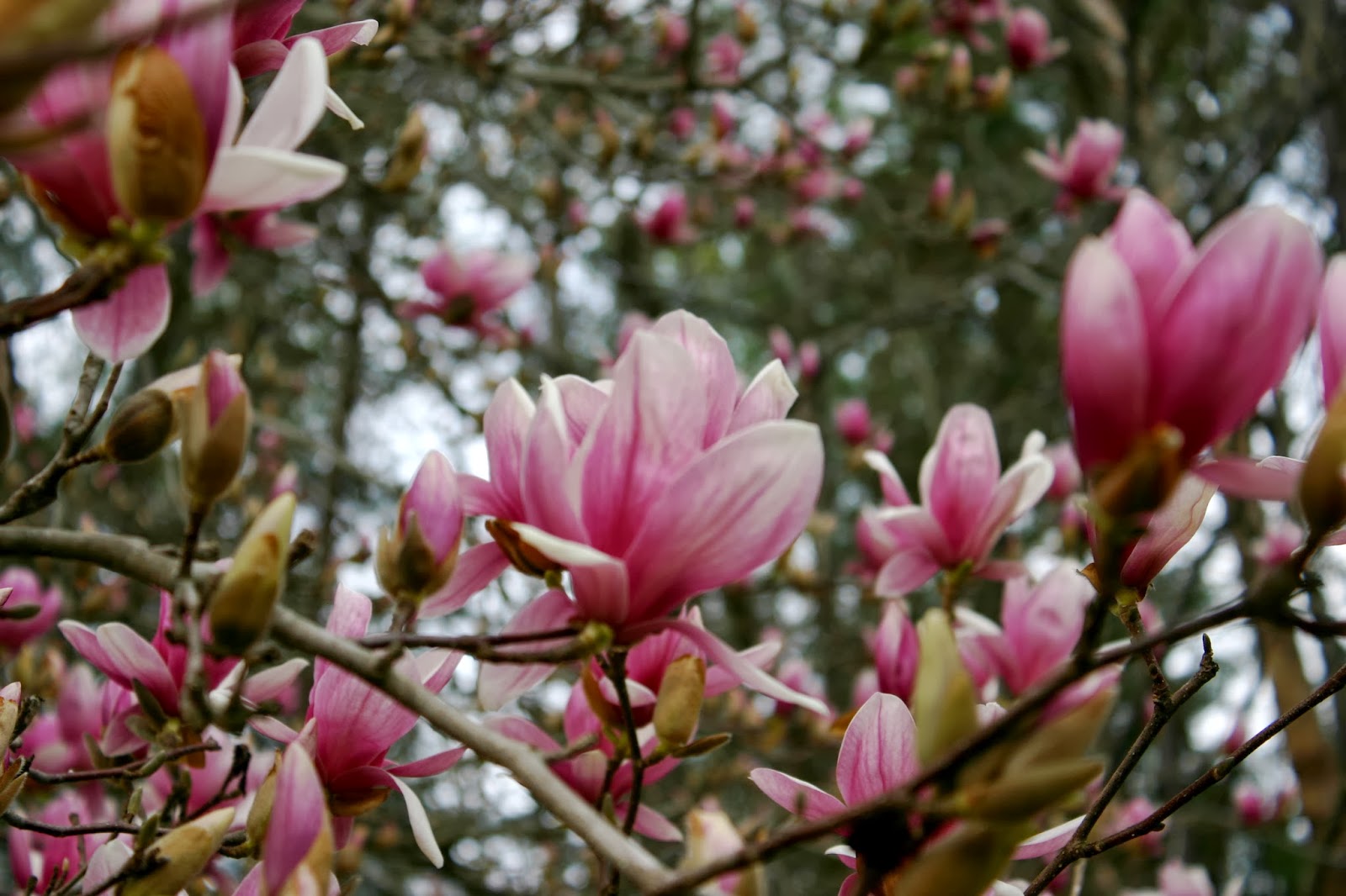
The coming weeks will see a great amount of change as we shift from Winter to Spring. With the warmer temperatures this past week, I've noticed that the tulip trees on campus here at USC in Columbia, SC are starting to bloom and daffodils are popping up everywhere around town. With the seasonal shift to Spring, I am sure that we will receive many wonderful condition monitoring reports from you about all of the changes you see.  We will look forward to highlighting the observations you share. Thank you for your efforts!


Tuesday, February 11, 2014

Winter Weather Condition Monitoring Reports

As we prepare for our second winter weather event here in the Carolinas we thought it would be helpful to share a couple of the reports we received after last month's snow event. Since this weather is a bit unusual for South Carolina, it is great to capture it in your condition monitoring reports to share how the colder temperatures and frozen precipitation affect your local environment.


On January 27th in addition to her regular reporting, a Beaufort County observer noted preparedness actions to get ready to measure snowfall: "Two weeks since last report. 0.68” of rain the first week nothing the second week. Cold, dry air masses with lots of wind have prompted several fire hazard warnings, especially this past week. Surprisingly, water levels in the lagoons are still up and draining. An unusual winter storm watch is in place for tomorrow and the next day with freezing rain and the possibility of snow. In preparation, I have removed the funnel & inner tube from my rain gauge."


Remember! Removing your funnel will allow you to capture snowfall to take the appropriate 'Melted Snow' measurement for your daily precipitation report. Be sure to check out the CoCoRaHS "In Depth" Snow Measuring training to learn more about how to correctly measure snow accumulation at: http://www.cocorahs.org/media/docs/MeasuringSnow2.1.pdf.

On January 31st, after the snow event, an observer in Pickens County noted "Soil moisture is a little above normal due to melting snowfall. Shaded areas still average about .25" of snow." This observer reported a total of 1.5" of snowfall at his gauge location on January 29th. 

And an observer in Aiken County, who submits her condition monitoring reports monthly, had a lot to share about how the cold temperatures and snow affected her backyard pond, lawn, and bird activity, among other great observations for the month of January:  

She writes, "I have a lot to report for the Month of January……. The month started out very rainy and wet, then the faucet turned off and plants dried up and turned brown as we shivered in the COLD temperatures. We ended the month with SNOW! My total rainfall to report for the month is 3.59" This is actually below average. Average rainfall is 3.91" for the Month. Heaviest rainfall occurred on Saturday January 10th 1.72" fell during the afternoon with a thunderstorm. Ironically, I remembered the old wives tale of thunder/lightning in January means snow in 10 days…Well; it was a little more than ten days after I heard that rumble of thunder, and it did snow. In fact I measured exactly 2 inches. When all that snow melted down into my gage the total melted snowfall was 0.23" The snowfall began around 8pm on 1/28 and lasted through the night into 1/29. The snow was on the ground for about 2 days before it all melted away. I did notice the birds were very active in the morning the day before the snowfall in my backyard. My daughter brought this to my attention. I think we saw a red cardinal, a few finches, and some blue jays. Maybe the birds knew what was ahead? Did I mention it was COLD??????? My lowest temperature reading was 15 degrees. I cannot remember what day that was. IF I remember correctly, the day we had the snow on the ground 1/29, the high temperature was only 31 degrees at the airport. This was a new record low max temperature for that date. Just in case you were wondering when the last time it snowed here, it was in January back in 2011. I have plenty of pictures from snowfall January 2011 and January 2014. My daughter had a blast….Me not so much; it was a big inconvenience & TOO COLD for my taste. Total days of measured precipitation this month with rain & snow was 12 days. Kind of shocking that we did not meet average precipitation even with 12 days of measured precipitation. Currently you can see a picture of my backyard pond with the snowfall on the ground as the cover photo on the NWS Facebook site. Very pretty, worth a look. Finally, my husband planted rye grass back in the fall with hopes of a pretty green lawn throughout the winter……..rye grass is just as dead as can be, it did grow, grass was green, but it just could not survive the frigid cold temperatures in the teens. Sago plants were green, now they are brown, palmetto palm fronds still are green, but they have a brownish/yellowish tint to them because of the cold temperatures. Hope this report is useful."

This report is most certainly useful! It contains a ton of interesting information and was fun to read. We hope that you are finding the information you report to be interesting as well. We will look for other great condition monitoring reports after this week's snow event to share how this winter weather is affecting folks around the state.  

Happy reporting everyone!


Tuesday, February 4, 2014

No Groundhog Needed


In case you missed it, Pennsylvania’s famous groundhog prognosticator, Punxsutawney Phil, DID see his shadow this past Sunday, which, according to legend, means we are in for another six weeks of winter. That probably comes as no surprise to many of us in the Carolinas, where memories of last week’s snow and ice event still linger. But before you rush out to replace your worn out winter boots for blustery weather ahead, the National Climatic Data Center (NCDC) in Asheville, NC reminds us that Phil’s forecasts are, on average, inaccurate.  "The groundhog has shown no talent for predicting the arrival of spring, especially in recent years," according to the center. In fact, the National Weather Service predicts a fairly good chance of above-average temperatures in the Southeast during the months of February and March as we move towards the first day of spring on March 20th. And, as of the beginning of February, most of the Carolinas are not experiencing drought conditions. But we don’t need a furry little rodent from Pennsylvania to tell us that. It is you and your daily observations and regular condition reports that keep local, state, and national officials informed about on-the-ground precipitation rates in our area. Whether the next few weeks are more like winter or not, your observations help paint a picture of the weather and its impacts in the Carolinas on our way to spring!